| Signed | |
|---|---|
| Author(s) | Anon |
| Illustrator(s) | N/A |
| Publisher(s) | Published by George Philip & Son Ltd and Philip, Son and Nephew |
| Published Date | c. 1957 |
| Edition | First Edition |
| Signature Information | N/A |
| Size | 19 x 10.5 cm (closed) 54 x 68 cm (open) |
| Book Condition | Nice, clean map, corners of cloth cover rubbed, very good condition |
| Jacket Condition | N/A |
| Binding | Linen-lined map, brown cloth cover with black titles |

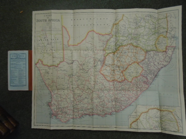
Philips’ Authentic Imperial Maps for Tourists and Travellers: Union of South Africa
£150.00
Colour map, scale of 1:2,500,000 (40 miles to an inch) with black title in the top left hand corner of the map
1 in stock