| Signed | |
|---|---|
| Author(s) | Anon |
| Illustrator(s) | N/A |
| Publisher(s) | Published by Ordnance Survey; David and Charles; |
| Published Date | 1879-1980s |
| Edition | Mixed editions |
| Signature Information | N/A |
| Size | 18 x 9 cm to 32 x 12 cm (folded) |
| Book Condition | Uncased maps are torn at folds in places, linen cases are marks and rubbed, creasing and marking to some, fair to good condition |
| Jacket Condition | N/A |
| Binding | Linen or paper maps |
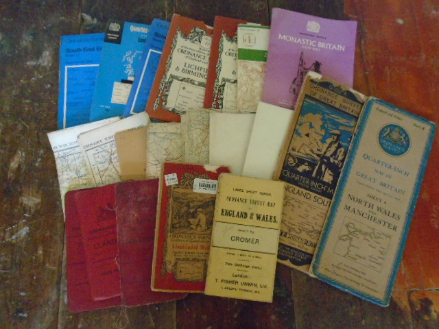
21 Old Maps [Including Ordnance Survey quarter inch and 1 inch to a mile, and War Maps]
£100.00
21 Old Maps Including: 5 Ordnance Survey quarter inch (One quarter inch Fourth Edition England, South, 1934; One quarter inch Norht Wales and Manchester fourth edition, 1946; 3 modern quarter inch 1960-70s); 9 Ordnance Survey 1 inch to a mile maps (including Essex from 1879; 1902 cased maps of Llandudno and Marlborough; 1901 cased map of Redditch; 1912 linen backed map of Cromer; 1922 road map of Llandrindod Wells; 3 modern maps without cases 1947-1961); 3 Ordnance Survey War Revisions 1940, Swindon (top part only), Yeovil and Blandford, and Portsmouth and Southampton; 3 modern reprints of Ordnance Survey Maps and Ordnance Survey Monastic Britain South Sheet
1 in stock