| Signed | |
|---|---|
| Author(s) | Anon |
| Illustrator(s) | N/A |
| Publisher(s) | Published by Carte Taride |
| Published Date | 1910s-1930s |
| Edition | Early editions |
| Signature Information | N/A |
| Size | 19 x 12 cm (folded), to 86 x 99 cm (open) |
| Book Condition | Some tears to map folds, envelopes of Carte Taride maps are torn, part of the Campbell map is missing, fair condition |
| Jacket Condition | N/A |
| Binding | Linen backed and paper maps |
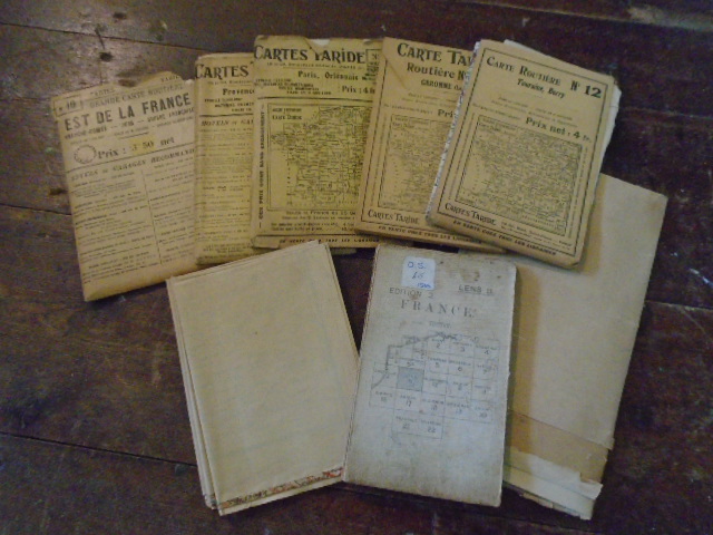

8 Old Maps of France [Carte Taride and Ordnance Survey]
£75.00
Collection comprises: linen backed Ordnance Survey Map of Lens, 1916 in colour; Carte Taride Routiere No.8 Paris, Orleanais in colour on paper c1920s, with its envelope; Grande Carte Taride Routiere No.10 Est de la France in colour on paper c1920s, with its envelope; Grande Carte Taride Routiere No.17 Provence, Basses-Alpes in colour on paper c1920s, in envelope; Carte Taride Routiere No. 12 Touraine, Berry, in card wallet c1920-30; Carte Taride Routiere No.20 Garrone in card wallet c1920-30; Part of Carte-Guide Campbell no.1 section l’ouest, c1930s; Nouvelle Carte de France by A.Taride with inserts of French colonies and Algeria and Tunisia c1910s
1 in stock