| Signed | |
|---|---|
| Author(s) | Camden, William, Gough, Richard, |
| Illustrator(s) | N/A |
| Publisher(s) | Printed by John Nichols for T. Payne & Son, G.G.J. and J. Robinson |
| Published Date | 1789 |
| Edition | First Gough Edition |
| Signature Information | N/A |
| Size | Folio, 47 cm x 29 cm |
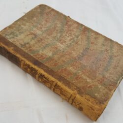
| Book Condition | Spines worn with chips, front board of Vol. 14 is detached, corners and edges of boards are rubbed, foxing to varying degrees throughout, additional pages have been added in places numbered with *, blank sheets in Volume 10 have inked numbers at the corners, ink annotations to some margins, a few maps with sparse colouring highlighting the roads, occasional spotting and offsetting, untrimmed edges, fair condition |
| Jacket Condition | N/A |
| Binding | Half morocco and plain paper covered boards, gilt titles and bands to spines |

Britannia: Or a Chorographical Description of the Flourishing Kingdoms of England, Scotland, and Ireland and the Islands Adjacent; From the Earliest Antiquity by William Camden, Translated from the Edition Published by the Author in MDCVII Enlarged by the Latest Discoveries, by Richard Gough in three volumes [Complete in 14 bound volumes plus 294 blank watermarked late 18th early 19th century sheets]
£1,200.00
Three volumes of Camden’s Britannia bound into 14 matching volumes comprising: Volume I, [40] xxii, [2] cxlviii. Volume 2, [40], cxlix, 1-54. Volume 3, [48], 55-146. Volume 4, [40], 147-210. Volume 5, [46, blanks] 209-312 (Kent, Gloucestershire and Oxfordshire), 3 fold-out maps and 1 plate; Volume 6, [40] 313-351, [36], contains the index for Volume I. Volume 7, [44], 1-164. Volume 8, [40], 165*- 325. Volume 9, [40], 327-440*. Volume 10, [58], 441- 598, [46], index to volume II at rear. Volume 11, [48], 1-146. Volume 12, [48], 147-264. Volume 13, [48], 265-456. Volume 14, [40], 459-760, [54], contains index for volume III. 148 plates including portrait frontispiece, title, half titles and dedication, additional titles to volume 7 and 11, ninety-four uncoloured engraved plates of coins and antiquities (including eight double page), and fifty-two double page and five single page engraved maps by John Cary and plates of artifacts, many double page or folding plus in text illustrations. These copies also contain 294 additional sheets (mostly blank, some with manuscript notes) various watermarks… “Taplin 1803”, “A. Stace 1801”, and others
1 in stock